Use Cases & Samples for Data Upload
This guide outlines common types of files you might have and links you to step-by-step instructions for uploading each kind.
We support a wide range of data upload formats, from CSVs with place names to precise latitude/longitude coordinates.
If you’ve got a dataset you want to visualize or analyze with mySidewalk, chances are we can help you get it mapped in just a few steps.
Geographic data uploads
If your CSV has a location column — whether it’s a city name, a full address, or a pair of coordinates — it’s considered geographic. Uploading geographic data lets you map your results, join it with mySidewalk’s data, and get spatial insights.
Uploading data with place names
- Use if: your file includes names of places (e.g., cities, counties, ZIP codes).
- Best for: Survey results by city, program outcomes by county, funding by ZIP code.
- How to upload data with place names
Uploading data with street addresses
- Use if: your file contains full addresses but not latitude and longitude.
- Best for: Lists of program participants, facility locations, or event sites.
- How to upload data with addresses
Uploading data with latitude & longitude
- Use if: your data already includes GPS coordinates.
- Best for: Sensor data, mobile tracking, or manually geocoded locations.
- How to upload data with lat/lon coordinates
Uploading data with GEOIDs or SHIDs
- Use if: If your file uses geographic codes like Census GEOIDs or mySidewalk SHIDs, this is the most direct way to match to our map boundaries.
- Best for: Pre-analyzed public data like Census tables or health outcome reports.
- How to upload data with GEOIDs or SHIDs
Uploads without geographic information
Not all insights need to be mapped. If your data doesn’t include any geographic information, you can still use it to create charts and tables.
- Use for: time series, funding categories, program results, or anything else you want to explore without mapping.
- Best for: Annual budgets, community survey summaries, or tracking data.
- How to upload data without geographic information
Need help matching your data?
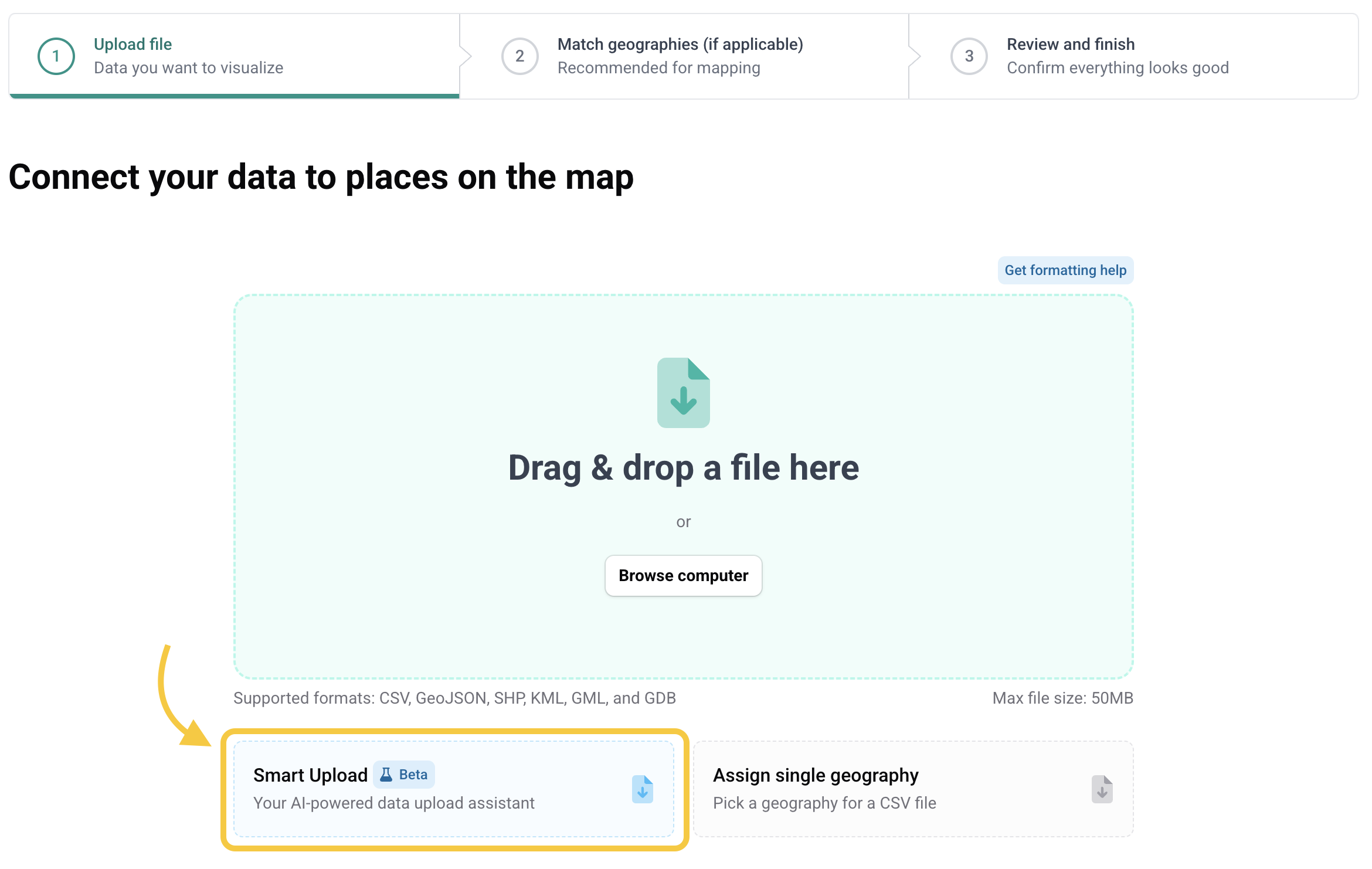
Not sure which category your file fits in? Our upload assistant (see screenshot below) will guide you — or reach out to our support team and we’ll help you find the right path.
